A section of a partially built residential project with only two houses in place, near Fort Myers, Florida.
Map. (© Google)
 2
2
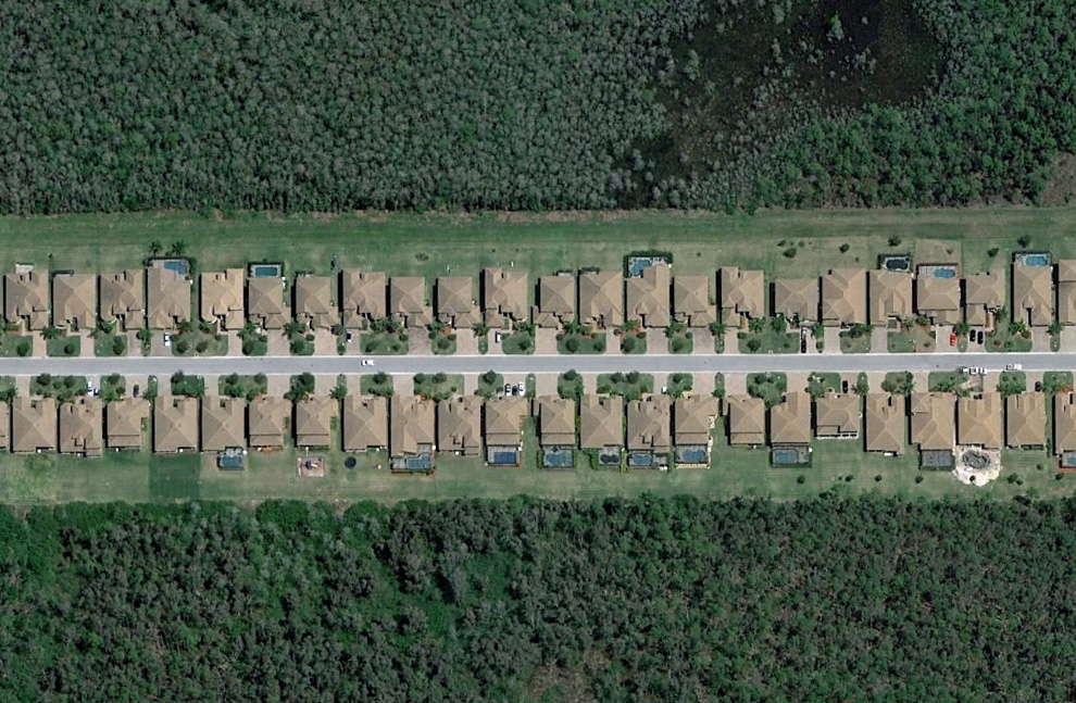
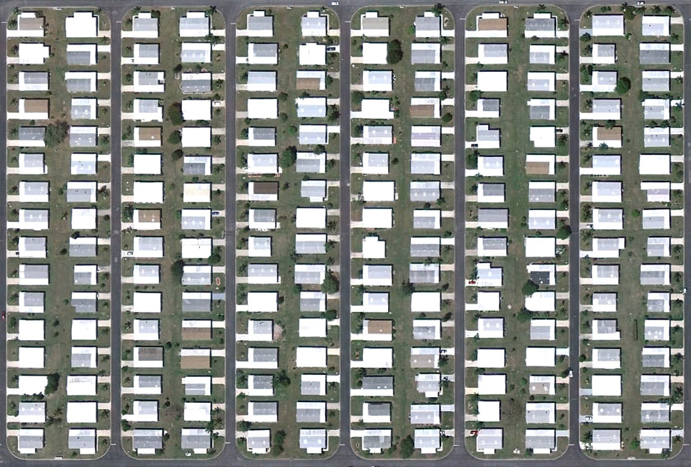
A strip of houses in a neighborhood southeast of Fort Myers, Florida.
Map,
Street View. (© Google)
#  3
3
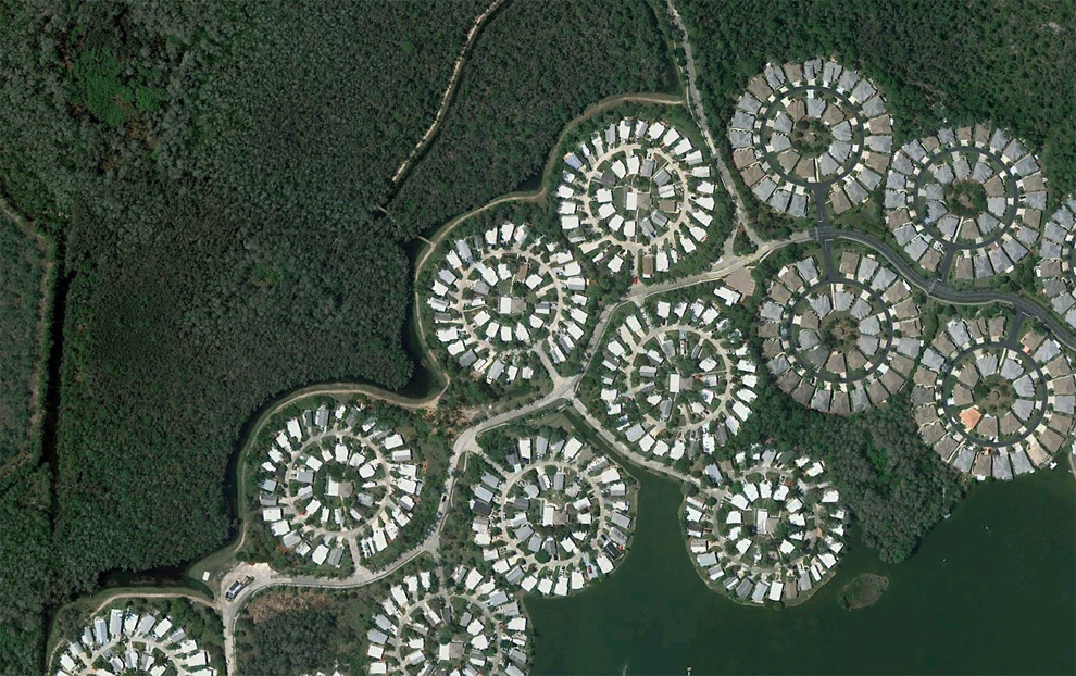
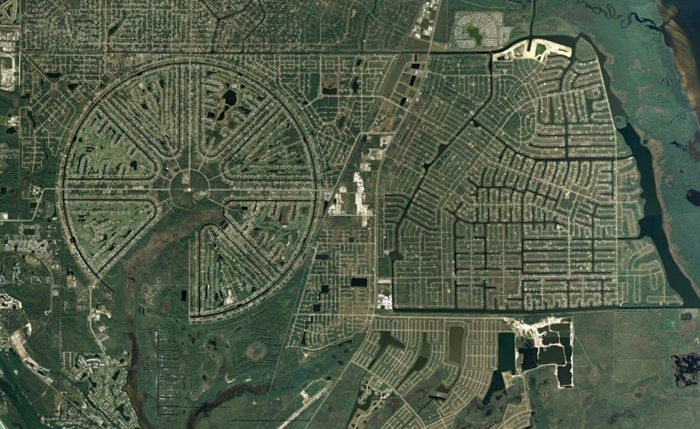
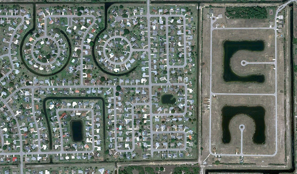
Circular layouts of homes near I-75, southwest of Fort Myers, Florida.
Map. (© Google)
#  4
4
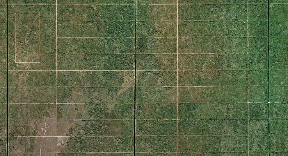
Once proposed as the 57,000 acre "Golden Gate Estates", this area was to be the largest subdivision in America in the 1960s. Many canals and roads were built, but the development eventually went bankrupt. Over the past 20 years or so, the land has been acquired by the state, and converted into the
Picayune Strand State Forest.
Map,
Street View. (© Google/USGS)
#  5
5
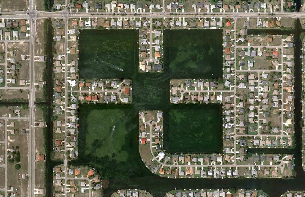
Boats make their way through canal structures in a neighborhood north of Cape Coral, Florida.
Map,
Street View. (© Google)
#  6
6
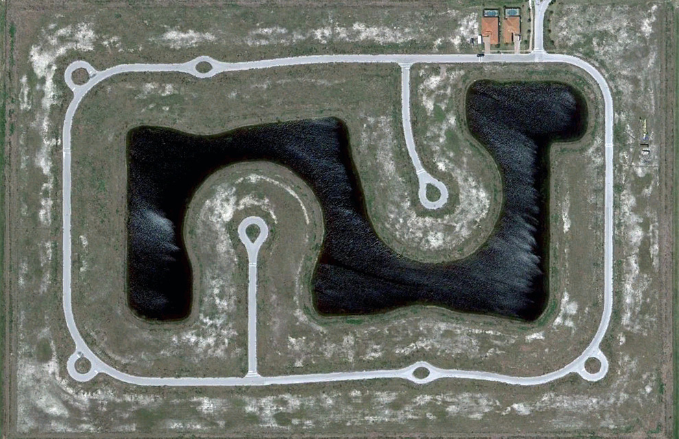
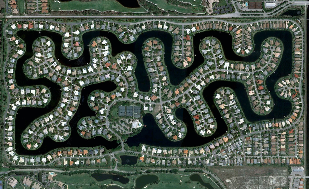
The Rotonda West neighborhood, originally developed in the 1960s, never quite fully completed, located in Charlotte County, Florida.
Map,
Street View. (© Google/Data SIO, NOAA, U.S. Navy, NGA, GEBCO)
#  7
7
A densely built gated community in Bonita Springs, Florida.
Map,
Street View. (© Google)
#  8
8
A community built around a man-made lake southeast of Bonita Springs, Florida.
Map. (© Google)
#  9
9
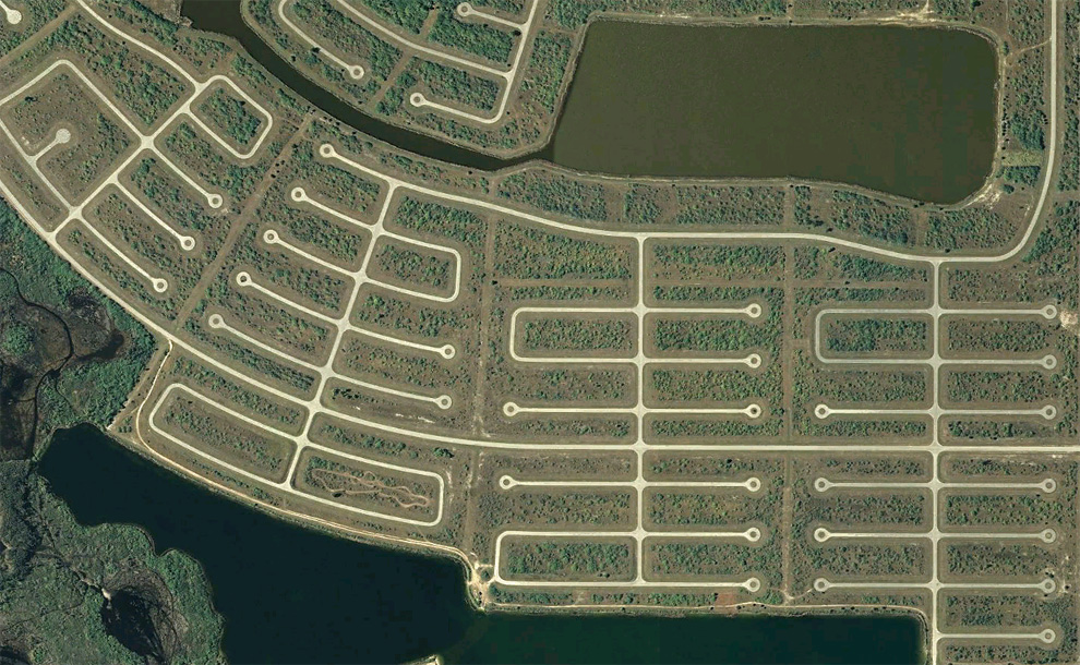
Empty cul-de-sacs fill an area south of Rotonda West in Charlotte County, Florida.
Map,
Street View. (© Google)
#  10
10
A developed neighborhood and one under construction in Lehigh Acres, Florida.
Map. (© Google)
#